Multispectral Imagery
Monitor the health of crops, sod, and other agricultural assets with the latest camera technologies.
Drone-mounted multispectral imaging camera sensors empower you to manage crops, soil, fertilizing and irrigation more effectively. You can reduce water waste and minimize the use of sprays and fertilizers while at the same time improving plant health or increasing crop yields. To learn more about how you can leverage multispectral data for field intelligence, give us a call at 972.318.2811, or contact us online.
More Than Meets the Eye
This video provides a simple illustration of how multispectral images can be used to compare field health over time. This data can be used to:
- Optimize irrigation distribution
- Determine whether certain fertilizers are performing better than others
- Monitor crops throughout the season to quickly remedy issues that could destroy a harvest
- Compare plant health year after year to see whether changes have improved outputs
Using multispectral data captured by drone, we can even leverage AI processing to calculate and project crop yields by allowing a computer to do a stand count analysis.
Seeing the Full Spectrum
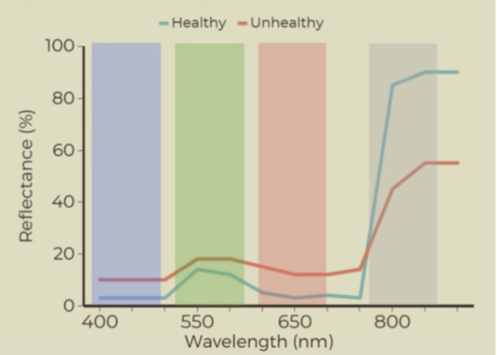
Plants convert sunlight into energy to grow, but we only see a fraction of the spectrum. The sun also emits ultraviolet and infrared light that is invisible to the human eye. Capturing the full spectrum can uncover key insights because of how plants react to each type of light. A healthy plant absorbs a lot of red and blue light, but reflects green light. Healthy plants appear greener, because our eyes see the green reflected from the spectrum. But healthy plants also reflect a lot of infrared light, which we cannot see. And unhealthy plants do the opposite; they absorb less red and blue and reflect much less infrared. This is why drones are such an important tool for agricultural management.
Data at Your Fingertips
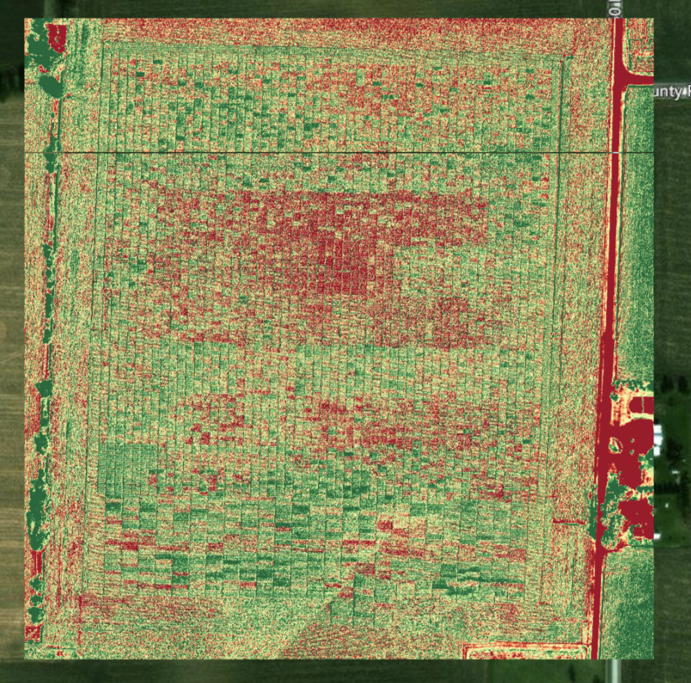
Today we can equip a drone with a sophisticated multispectral camera that can isolate red, blue, green and infrared light. This enables us to create a plant health map which provides up-to-date pinpoint accuracy so you can make data-driven decisions to produce higher crop yields or protect your investment in park fields or landscaping year after year. Global Video gives you easy access to the specialized equipment and trained professionals you need to collect, process and interpret the data. This information lets you spend less time guessing and more time doing, and can save you both time and money for managing your agricultural assets.
Improve Your ROI
Our job is to make your job easier. We’re passionate and committed to our clients to give them all the tools they need to succeed. We would welcome the opportunity to schedule a call or meeting and learn more about your current needs, to see how we can best serve you. Call 972-318-2811 or contact us online to explore the possibilities.
 972-318-2811


